
Timberline Trail Counterclockwise
Timberline Trail is a much-loved hike that circumnavigates Mount Hood. It is popular among ultramarathon runners, taking 8-10 hours for those superhuman runners who decide to tackle the ~41 and 10,000+ feet elevation in the most extreme of ways. Other overachievers consider this a very long day hike, one of the most challenging in the U.S.
I first became aware of this hike a year or two ago when I was invited to accompany a friend. The timing didn’t work out, so I put it aside until June when I was invited to join in a group of three other guys (in their late 40s—mid 50s) eager for our first backpacking adventures.

Timberline Lodge to Tilly Jane Campground
15-16 miles | 6 hrs 13 min moving time (10 hrs 37 min elapsed) | 3,631 feet elevation
I awoke at dawn on Tuesday morning, having slept fitfully all night long despite being tired from an afternoon hike to Cooper Spur getting acclimated to the elevation and area. My companions, mostly tucked into their own small tents or simply asleep under the stars, shared in lack of sleep.
We had decided to take our hike in a counterclockwise direction after reading a bit and talking to some locals in Portland much more familiar with the hike. Our grand plan was to leave a car behind at the Tilly Jane campground where we would arrive hungry and exhausted Tuesday night ready for a grand feast of burgers, our backpacks lighter with the knowledge we would find our supplies safely stowed in the car.
As the crow flies, Tilly Jane is not so far from Timberline Lodge. But by car, it is nearly an hour and a half with the rutted dirt road near Tilly Jane the slowest portion of the trip by far. After packing up camp, we wouldn’t arrive at Timberline and get started on our hike until close to 11AM. With an estimated 16 miles to hike, we knew it would be a long, long day…
As the runner of the group, my first order of business was to head up to Timberline Trail going west 1/2 mile to the box where I would leave our wilderness permit neatly filled out. Why there isn’t a similar box heading east is a mystery. For me, this added a mile roundtrip but by the time we were ready to hike I was loosened up.
Disclaimer: I didn’t take notes on the trail, despite my best efforts. Each evening I was just too exhausted and writing was the last thing on my mind. So please don’t base any important planning on the following collected memories.
Section 1: From Timberline Lodge to White River
Area day hikes include the White River Trail (3.4 miles)


Section 2: White River to Mt Hood Meadows
Area day hikes include Umbrella Falls, Elk Meadow 667C & Elk Meadows South Trail


Section 3: Mt Hood Meadows to Gnarl Ridge
Area day hikes include Newton Creek-Gnarl Ridge Loop
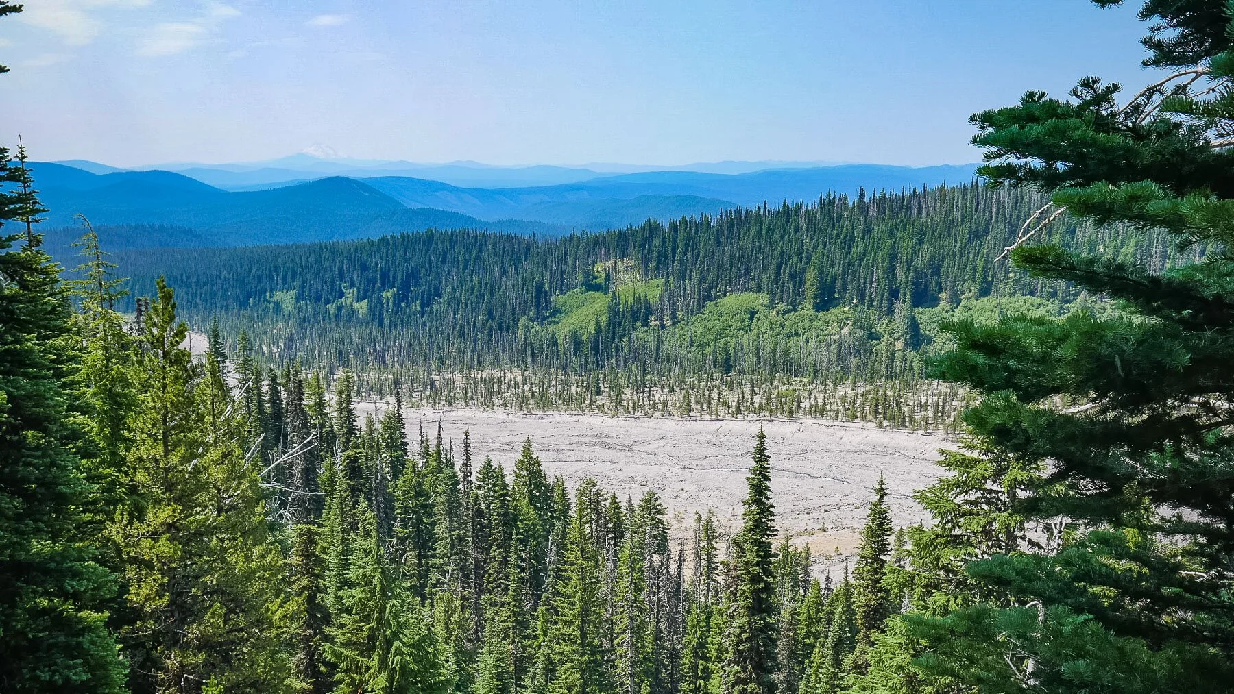
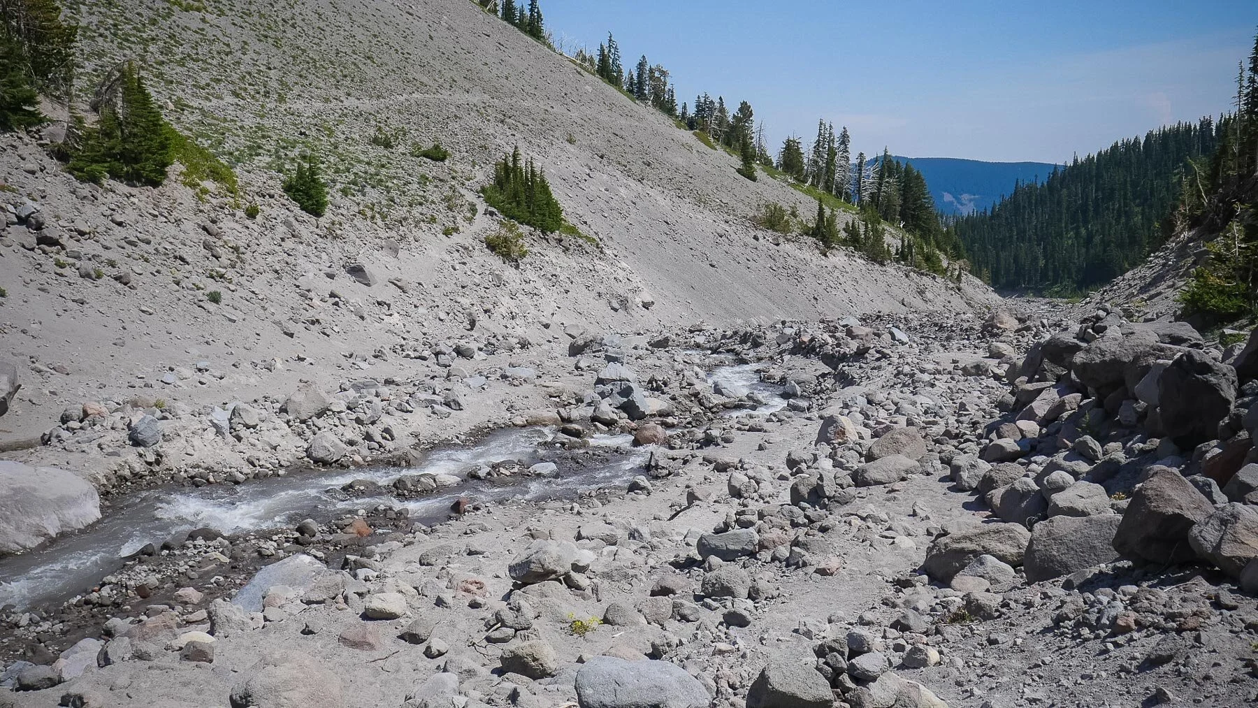
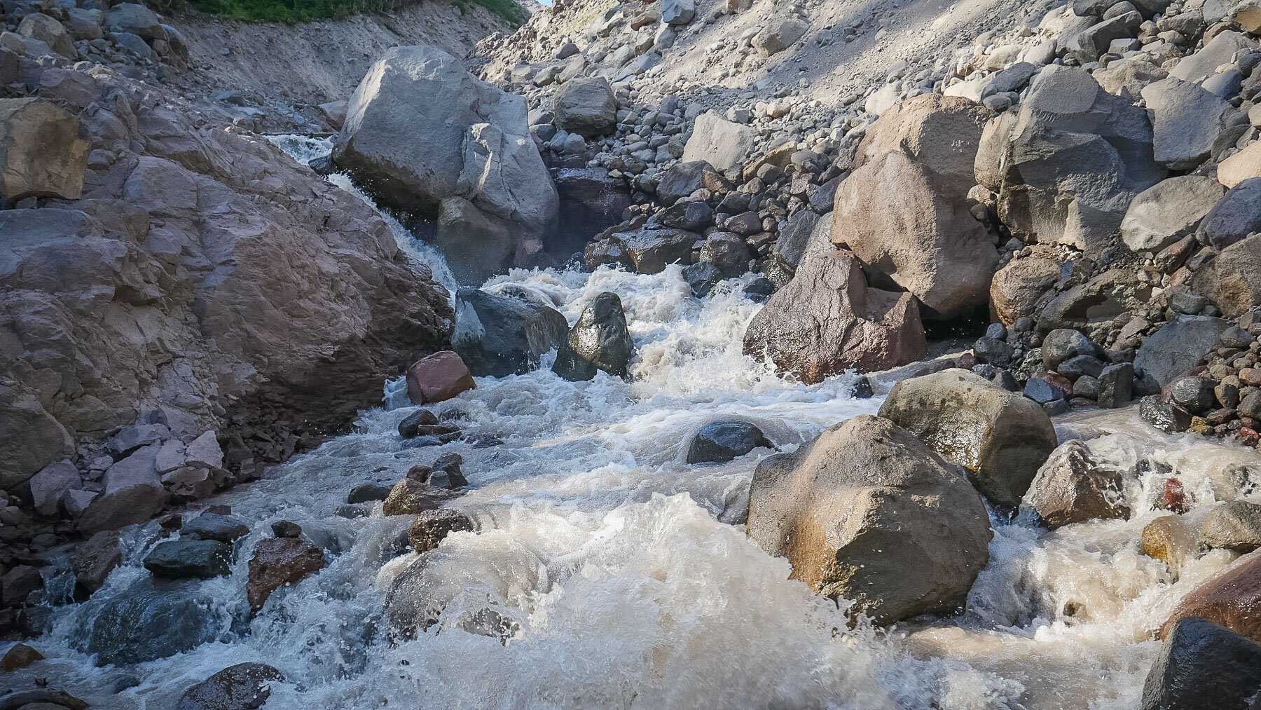
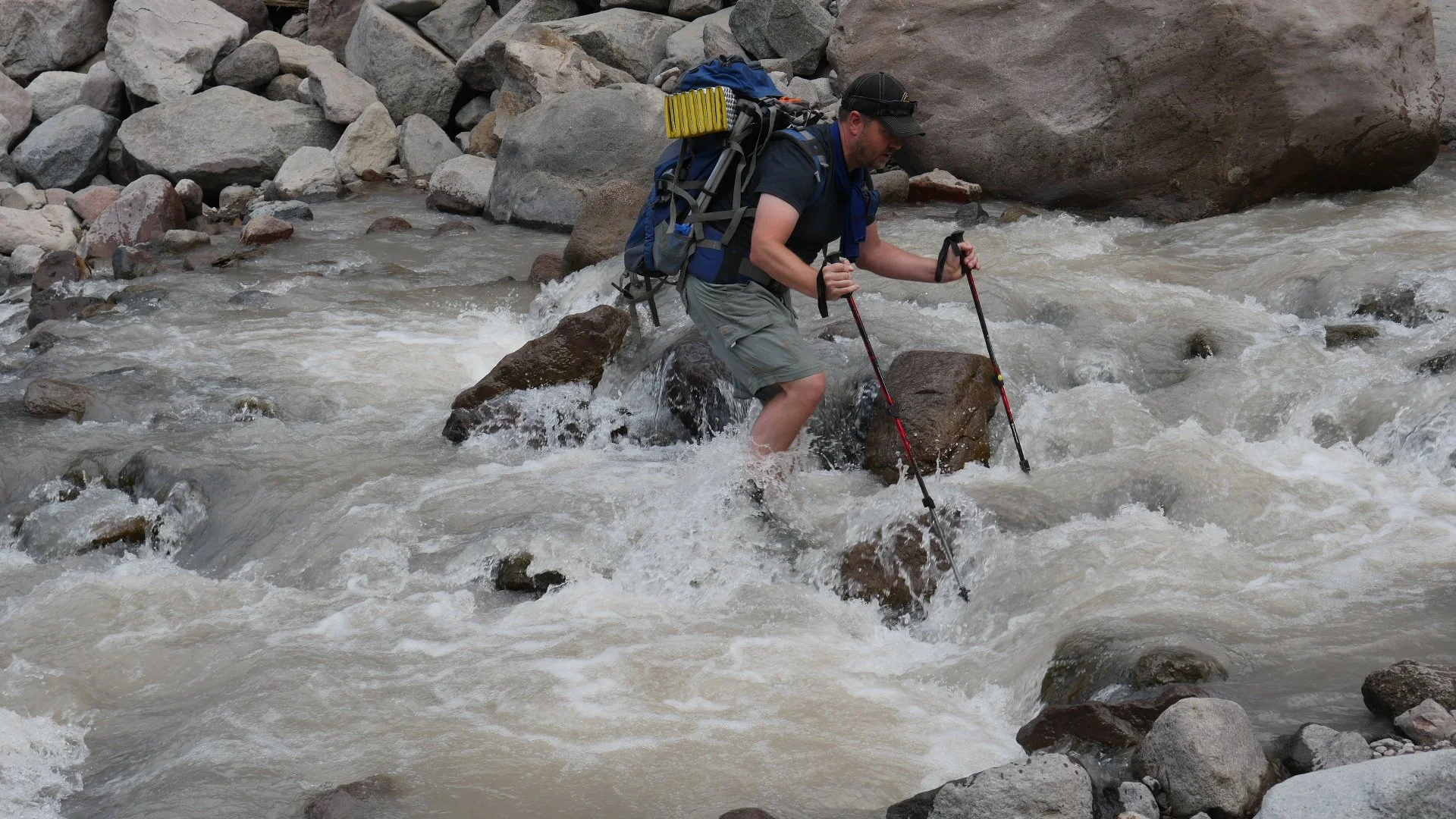
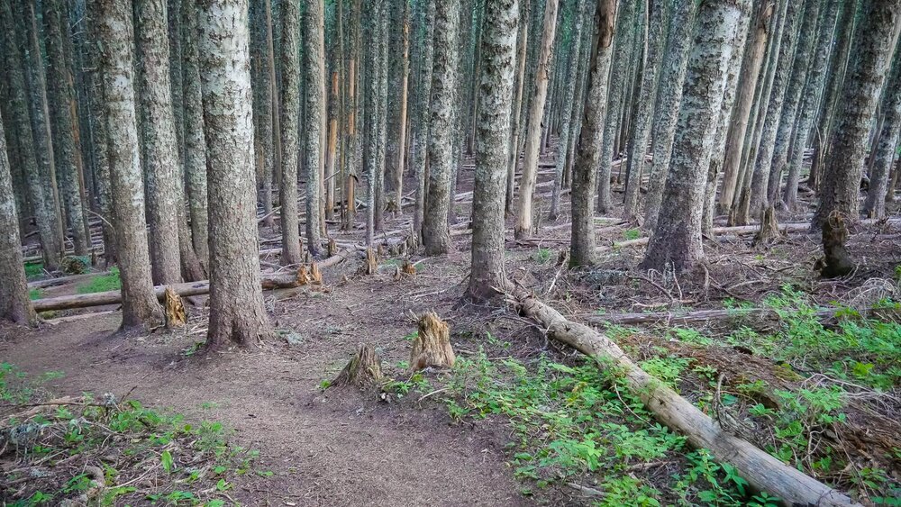
AREA TIP: Our group made an unfortunate and exhausting mistake around this area. In the first few photos of the grouping below, we came upon this barren area and initially crossed at an easy spot, thinking we could simply head down river. However it appeared that the trail on the other side of the river was quite a ways up the barren landscape. How could we get up there?
We headed down river, having to cross back over to our original side at the bank ran out. We found another spot to cross, but there was no way to reach the path up the mountain unless we were willing to speed up the VERY loose gravel in a zigzag pattern. It was seriously exhausting work, and something likely not very possible without our hiking poles to help propel us along.
Don’t make this mistake. Simply head back up stream and follow the trail. Usually there are cairns (piles of rocks) that lead the way, but that can become confusing when so many piles of rocks are also thrown together due to the workings of the river in some places.


Section 4: Newton Clark Glacier to Tilly Jane Trail
Area day hikes include Tilly Jane Trail, Cooper Spur via Eliot Glacier View
We arrived at Tilly Jane to find the parked car unmolested, a wonderful site indeed knowing soon enough we would be eating grilled burgers. But first, bivy sacks and tents were erected as night was coming quickly. We arrived to camp around 8:30PM making this a 10-hour hike more or less.


Day 2
Tilly Jane Campground to Bald Mountain
12.4 miles, equiv. 101 floors elevation, about 12 hours hiking time
As the sun rose and activity around camp picked up, our main concerns apart from sustenance included packing properly knowing that we didn’t have any cars parked near Ramona Falls, our intended destination. As it would turn out, our feet would only carry us to Bald Mountain near the odd intersection of multiple paths (Top Spur McNeil Point trailhead being the closest road access point). But the sights along the way would become our favorites, especially around Elk Cove and Cairn Basin.
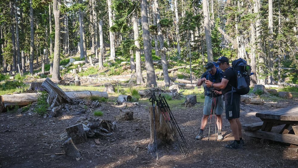
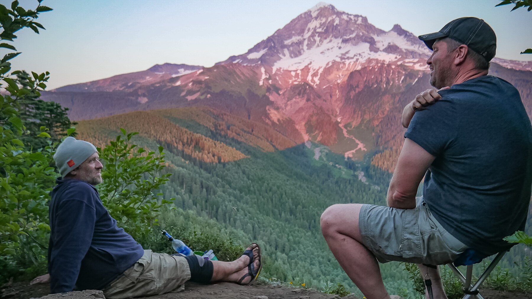
(pic: Brett and Chon discuss the day ahead of us from a packed-up camp at Tilly Jane)
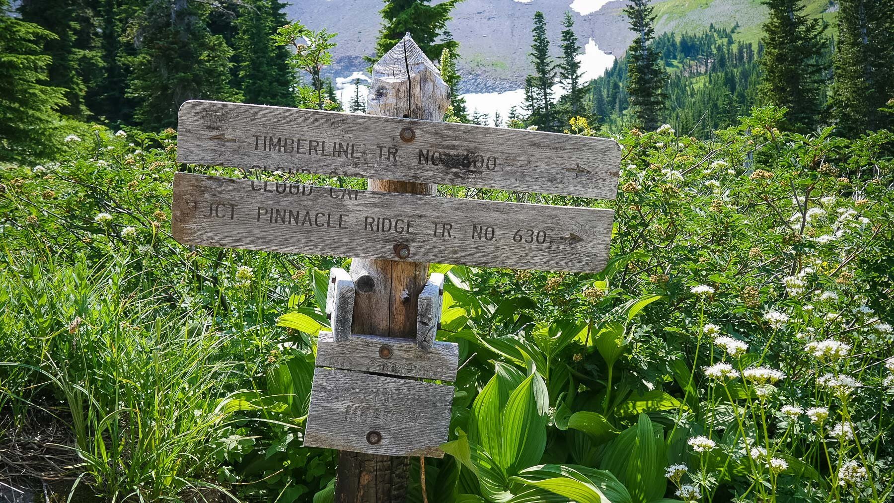
Between Cloud Cap and Pinnacle Ridge Trail junction
Area day hikes include Cloud Cap to Elk Cove, Cooper Spur via Eliot Glacier View, Tilly Jane, Pinnacle Ridge


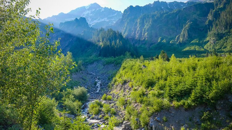
Elk Cove, Wy’East Basin, Cairn Basin to Bald Mountain Ridge
Local area day hikes include Elk Cove, Barrett Spur via Vista Ridge and Wy’East Basin, Vista Ridge to Cairn Basin, Bald Mountain from Lolo Pass, Mazama Trail
AREA TIPS: 1) bug repellant… Commence incredibly annoying insect onslaught along this section. At least the flies are dim enough that you can kill them even with the slowest of hand slaps. 2) stock up on water around Cairn Basin


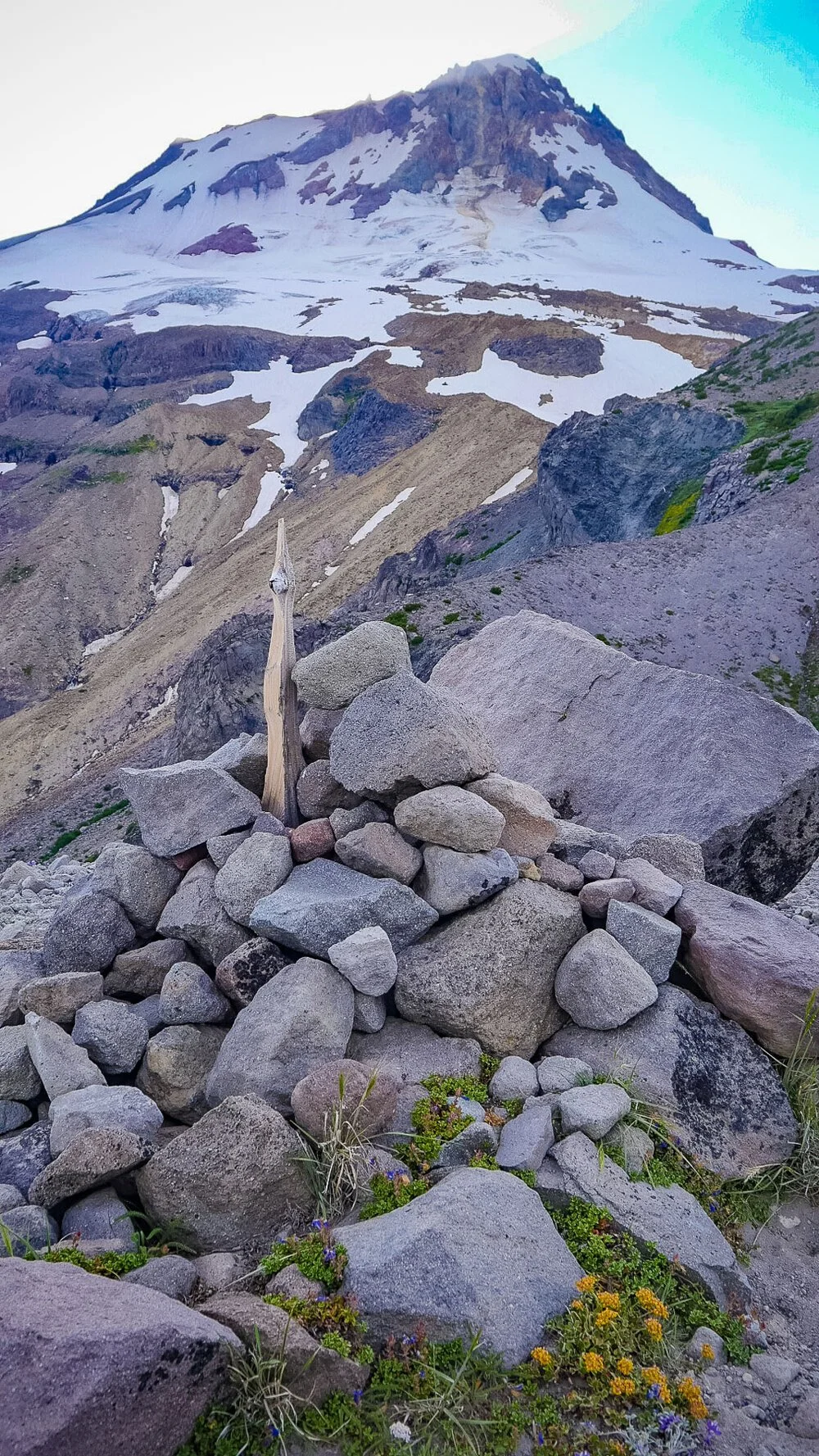
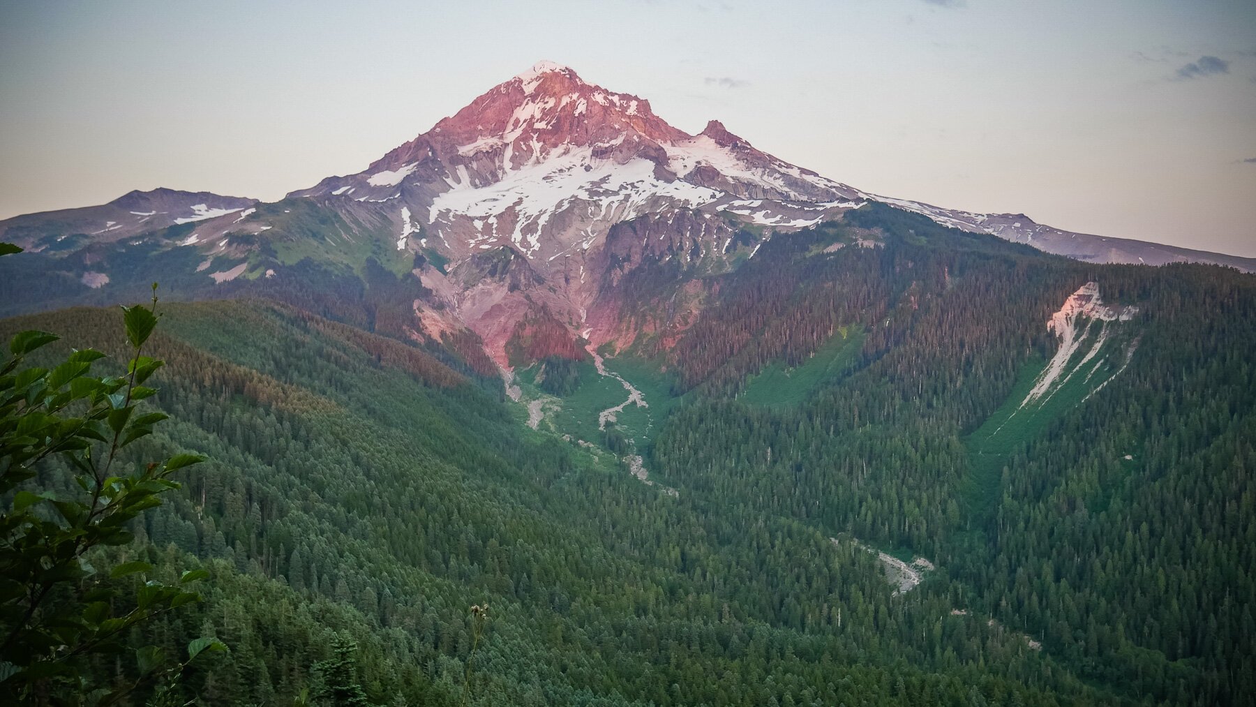
The view from the top of Bald Mountain, our chosen campsite for night #2
Day 3
Bald Mountain to Timberline Lodge via Ramona Falls
20.7 miles, equiv. 203 floors climbed elevation, 14 hours hiking time est.
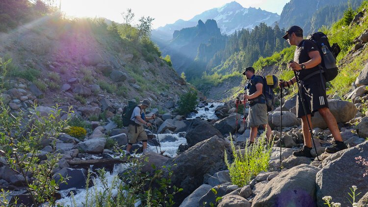
Camp was an easy teardown and we were eager to get on the trail knowing our final day would include many rugged miles if we hoped to make it back to the lodge before dark. Mike and I volunteered to go find water, the past 5 or so miles of Bald Mountain Ridge being completely dry. Hikers informed us that the trailhead area for Top Spur McNeil Point included a small trickle of a stream, so off we went with our own and other bottles while Brett and Chon tore down a bit slower so they could meet us on the Timberline Trail where the Bald Mountain trail began.
Our night of rest was mixed. I awoke in the middle of the night on several occasions sure I heard wildlife around us. Based on what I heard, I believe it was a mule deer. The night before we bedded down we scanned the large branches above our site recognizing that a strong breeze could topple a few “widow makers”. We removed a large sketchy looking tree top dangling above us.
Heading down Bald Mountain in search of water at Top Spur McNeil Point trailhead
From Bald Mountain to Muddy Fork
Local area day hikes include Bald Mountain from Lolo Pass, Bald Mountain and Muddy Fork, Top Spur and Timberline
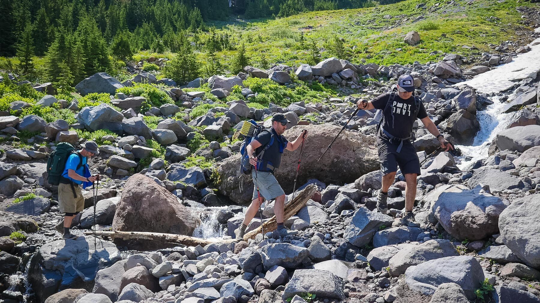
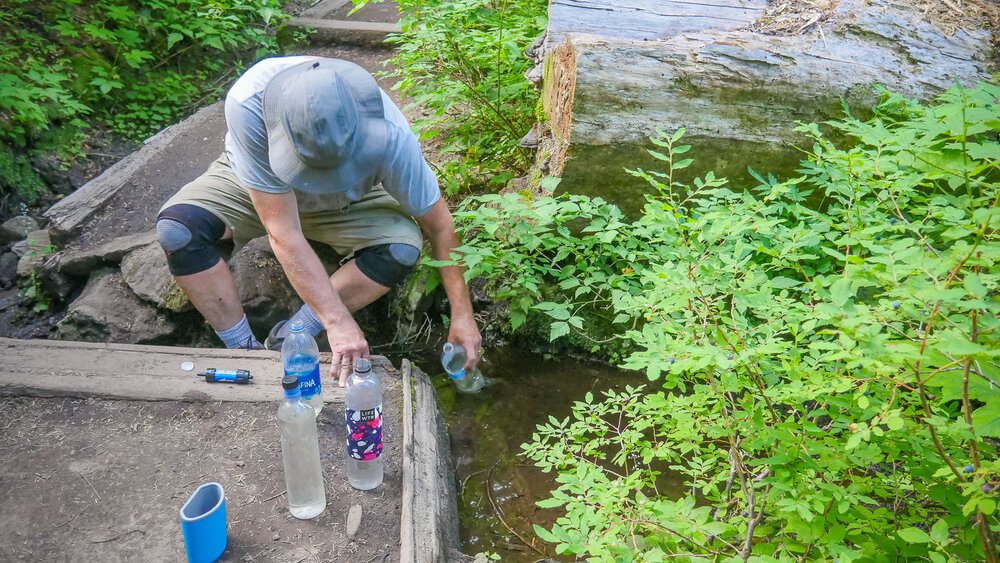
The first few miles of our morning were beautiful, but dry. It took probably 1-2 hours before we came upon running water, so we were grateful to have gone in search of water before starting off for the day. But once we found the mini waterfalls (which also means landslide and loose rock in some areas), most of us dumped the dirtier water for cleaner. Our chosen water filtration included the Sawyer Mini for those who chose to use their own water bottles, and for myself the MSR Thru-Link In-Line so I could simply attach it to my 3-litre camelback system. I was the only one in the group who could stay hyrdrated without stopping for water breaks, and because I had 3 litres I was amply supplied between water options (though I made the mistake of not filling up as often as I should have before camping on Bald Mountain. Pulling the water reservoir out of its place in my pack is a bit of an unwelcome chore I tried to do as little as possible.)


Ramona Falls and the Sandy River area
Area day hikes include Ramona Falls, Sandy River
AREA TIP: be careful in the area between Ramona Falls and Muddy Fork as it is prone to landslides. We carefully crossed over an area in which small stones were constantly in motion downhill. Several areas along the path were close to being destroyed.


Reid Glacier Falls and Paradise Park
Area day hikes include PCT-Paradise Loop 757 & Trail 778, PCT to Paradise Park Loop 757
Our band of brothers unravelled, just a bit, right here in this Paradise Park area. We began to spread out enough that we lost track of where each other was. Some took the Paradise Park loop to enjoy the scenery while one guy lagged behind suffering the effects of what would become dehydration and heat exhaustion. While we pressed on, he was unable to do so having run out of water in some dry stretches of the journey from the Sandy to Paradise Park. The hills were pretty intense and if it weren’t for a very well prepared and caring fellow hiker who stayed with him and donated much of her own water, our outcome may have been much worse. During the same day we later read that 3 other hikers had to be rescued due to dehydration or other problems.


From Little Zig Zag Canyon to Timberline Lodge
Area day hikes include Timberline Lodge to Little Zig Zag Canyon
The Zig Zag Canyon area became quite familiar to us as half of our group arrived to rest by the frigid waters hoping those behind would soon catch up. While two of us napped and regained our energy, our dehydrated companion recovered enough to meet us in the shade along the river while another had set himself up at a trail junction hoping to find the guy who had become dehydrated. They missed each other, but due to the very active communication network of other hikers, we were able to locate him just 1/3 mile up the trail. I ran to meet him, letting him know the three of us were all now at the river and ready to begin our final leg to Timberline Lodge.


After so many days on the trail, our hopes were high that we would be able to relax at Timberline with sundowners and burgers. But at 9PM during the COVID era, only the Cascade restaurant dining area was open and it was clear our ragged group was not the type of patron welcome. One of our guys was desperate for a drink of water from a real glass, so a nice waitress brought that over to us while we made a plan to head to Hood River, Welches or Sandy for some grub.
Our initial plan all along was to simply drive to Tilly Jane to get the other car, but we were all way too exhausted to add another few hours to our night. Instead we hit up a a grocery store in Welches then a McDonalds drive through in Sandy (one of the only available options open this time of night). And while I tend to avoid McDonalds and probably haven’t eaten in one for years, a Quarter Pounder with Cheese and Large Fries was very welcome after our days up on the mountain.